

Editor’s note: A large section of this article - about half - was missing when it was originally published. We’re republishing the complete article today. Please continue reading below to see the previously missing sections.
Nick Bello is a writer and photographer based in Park Slope. He loves to capture local scenery as well as research local history. Follow him on Instagram @nbello8 or on substack at:

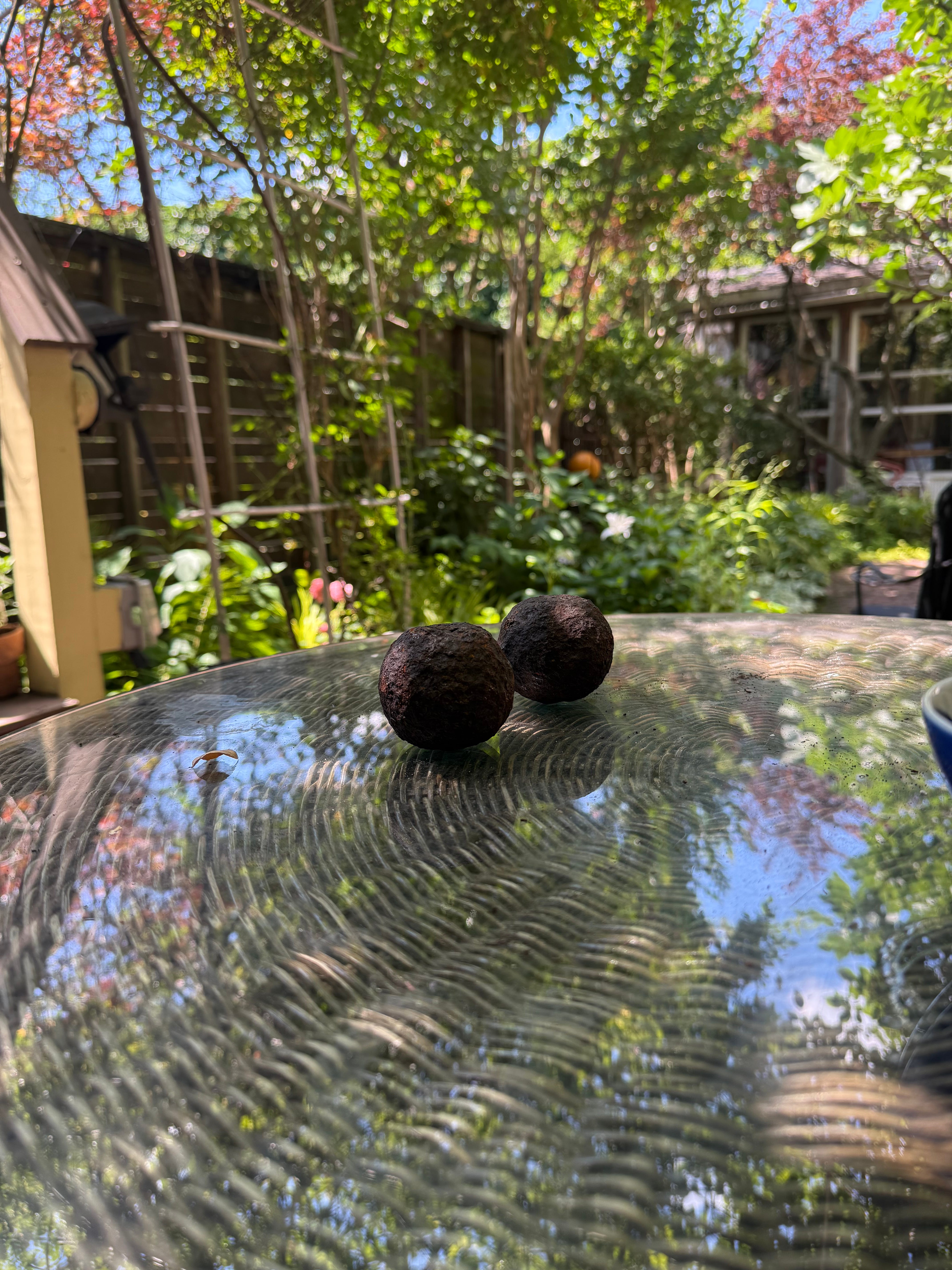
Atop the glass patio table before me, in the backyard of artist Bettina Magi’s Red Hook home on Coffey Street, are a bowl of cherries, a bowl of nuts and two cannon balls from the Revolutionary War. Magi points to the fig tree at the back of her yard. It grew from a clipping from her father’s childhood home in Italy that he brought here in 1914, sneaking it under his coat as his boat made its way past the Statue of Liberty toward Ellis Island. Magi says the cannon balls were found under that fig tree by her son Paul under unfortunate circumstances.
Years ago when Paul was young, he had a bunny named Barrington who died and was buried under the fig tree. Barrington was named after Great Barrington, the town in Massachusetts where they got him. To bury Barrington, who was a rather large bunny, Paul dug a two-foot hole beneath the fig tree under the watchful eye of his mother. In the process of digging the hole, Paul unearthed the two cannon balls, stunning Bettina.
A Fort Called Defiance
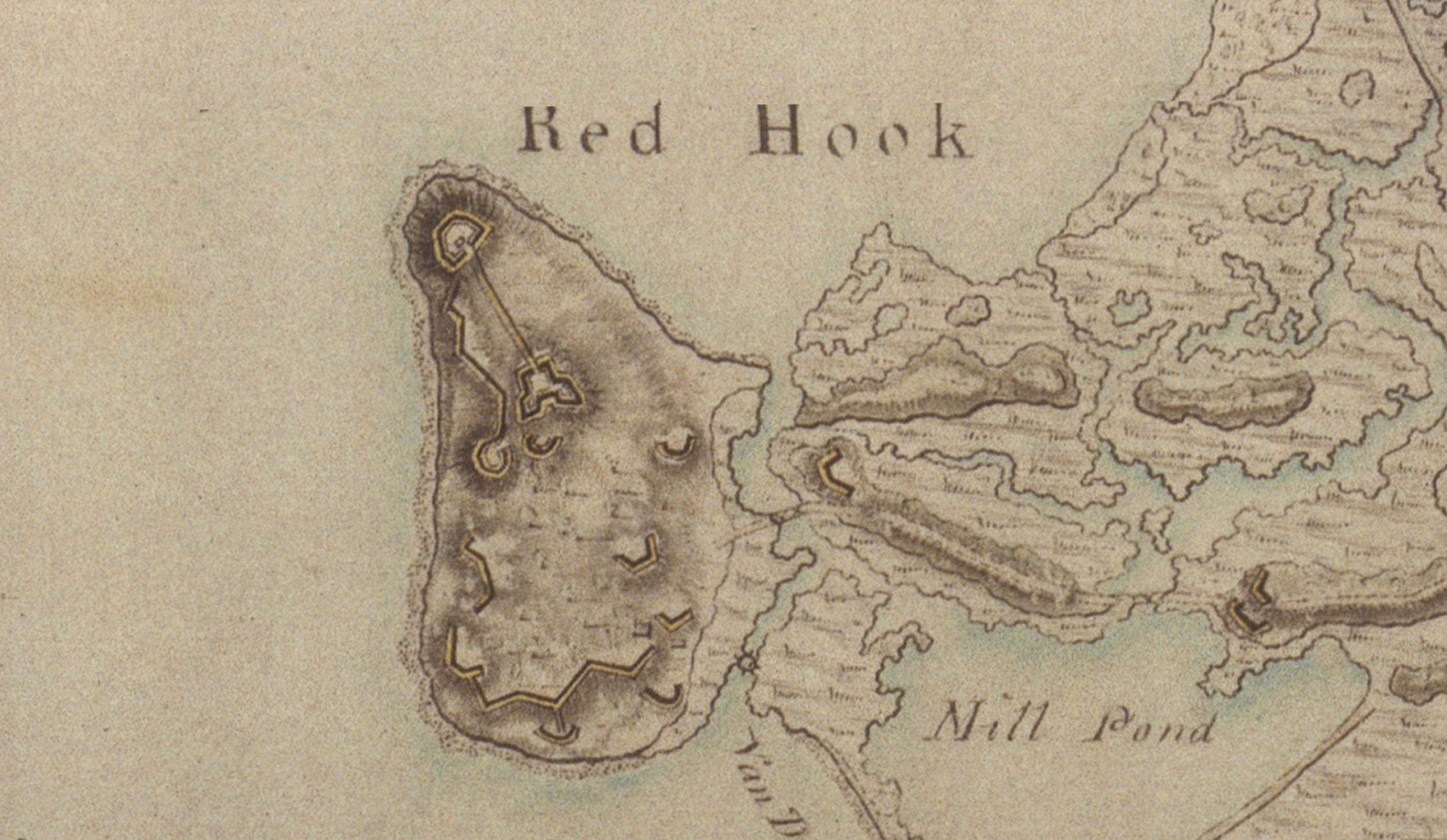
Long before Red Hook was Red Hook, it was a series of marshy swampland that the Lenape people called Ihepetonga. When the Dutch settled in the area in 1636, they called it Rood Hoeke, after the red (Rood) clay soil that was found there and the Dutch word Hoeke which translates to “point” or “corner”. Red Hook featured a large landmass with an estimated elevation of 40-50 feet named Cypress Tree Island, due to the number of Cypress Trees found there. The Continental Army fortified this hill in the early months of 1776 as the Revolutionary War turned towards New York. Crews of soldiers, along with forced laborers from Brooklyn (townspeople and slaves), worked tirelessly to complete it in just a few days. When Washington inspected the fort on April 10th, he said “Fort Defiance was small, but an exceedingly strong defensive position.” Furthermore, Major Samuel Shaw, who was stationed at the fort, had high praise for its construction:
“I am now [June 11th, 1776] stationed at Red Hook, about four miles from New York. It is on an island, situated in such a manner as to command the entrance of the harbour entirely, where we have a fort with four eighteen-pounders, to fire en barbette, that is, over the top of the works, which is vastly better than firing through embrasures, as we can now bring all our guns to bear on the same object at once. The fort is named Defiance. Should the enemy’s fleet make an attempt, they will, I think, be annoyed by it exceedingly. It is thought to be one of the most important posts we have.”
Fort Defiance was one of three fortifications built to control the East River. Along with these fortifications, the Continental Army sunk logs into the river that would tear up the hulls of any of the British ships that passed through. On June 9th, the British Army – under the command of General William Howe – set sail from Halifax en route to New York. Howe, along with his brother Admiral Richard Howe, compiled a force of more than 20,000 soldiers and hundreds of ships. Some conservative estimates say that the British brought 200 ships, while others say it was 400 ships. Washington did not find out about this until June 28th, one day before the British ships were sighted from Staten Island. A private in the Maryland Brigade of the Continental Army named Daniel McCurtin wrote of the scene:
“I spied as I peeped out the Bay something resembling a wood of pine trees trimmed…. In about ten minutes the whole Bay was full of shipping as ever it could be…. I thought all London was afloat.”
The British fleet eventually made landfall on Staten Island and met minimal resistance from the small detachment of Continental soldiers on the island. While the site of the massive British fleet was unnerving for the green Continental soldiers, there was cause for celebration in early July as the Continental Congress had signed the Declaration of Independence. However, this glorious news did not reach New York until July 6th. On July 9th, Washington ordered for celebrations to be held in Manhattan as brigades marched to what is now City Hall park, where Washington read the declaration. After the reading, mobs made their way over to Bowling Green Park where a giant statue of King George III was torn down and defaced. The head of the statue was paraded on a stake up to a tavern in what is now Washington Heights. The rest of the statue, which was made of lead, was reportedly brought to Connecticut and melted down to be turned into musket balls to be used by Continental soldiers.
This joy, however, was short-lived, as on July 12th, soldiers and residents watched in awe as two British ships, the Phoenix and Rose, sailed past the batteries at the head of New York Harbor and made their way up the Hudson River with ease. Washington was unhappy with his soldiers as instead of taking up arms to fire upon the two ships, they had stood around and watched the action, showing how inexperienced his army was.
On the morning of August 22, 1776 the British landed on the beaches of Gravesend, beginning the invasion of Long Island. In the days to come, skirmishes would break out between both sides as the British moved into position for the main assault. On August 24th, two British ships, the HMS Roebuck and HMS Repulse, set sail from Staten Island in an attempt to cut off Long Island from Manhattan where a majority of Washington’s army remained. As the ships set sail, however, it became clear that the weather would be a challenge as the much heavier Repulse had trouble moving. The much lighter 44-gun Roebuck was able to move, but the wind died out as the ship approached Fort Defiance in Red Hook. Seeing the stalled ship, Fort Defiance let her have it as the ship returned fire. Both would be heavily damaged as the Roebuck eventually made its way back to Staten Island.
On the morning of August 27, a detachment of the Continental Army fired the first shots of what would become the Battle of Brooklyn when they spotted British soldiers foraging for watermelon outside of the Red Lion Inn that was located in present day Sunset Park. Over the next 24 hours the British would show their might, outflanking the Continental Army and forcing them to retreat across the Gowanus Creek to the safety of what is now Cobble Hill. It appeared that Washington’s army was on the brink of annihilation.
On the night of August 29, Washington began evacuating his army to Manhattan from the Brooklyn ferry crossing using boats that were operated by Colonel John Gloover and his men, who were sailors and fishermen from Marblehead, Massachusetts. Under the cover of darkness, the Continental Army evacuated across the river with haste and order. As the morning sun began to rise, a fog settled over the river allowing cover for the last remaining troops of Washington’s Army to escape. By 7 AM, all 9,000 troops made it safely across the river.
Revealing The Past
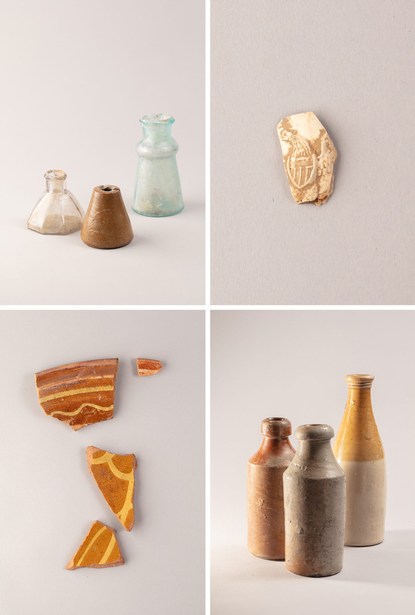
Jonathan Bream has a cool perk to his job as a construction inspector for the New York City Department of Design. “I can actually do a little bit of the archaeology and pull some stuff out of the ground or whatever that’s coming up,” Bream told me. “They’re allowing me to do that as long as I don’t get in the way of the construction.” Like Bettina Magi, Bream also unearthed a cannonball one day while working on Reed Street and Van Brunt Street in Red Hook.
“Well, actually, when I first found it, when we first pulled it out of the ground, it was just a hunk of metal. But then I saw the cannonballs that Bettina had unearthed when she dug a grave for her rabbit.” Bream said. “It’s like, oh, this looks pretty much the same. And then with that, I figured it was the older stuff because what we were finding there was redware, what I call the sgraffito wear, or Dutch redware. Then I just put two and two together and it was probably a cannonball. We looked at it, took some measurements… and all seemed to be saying that it was a cannonball. Now, how it got where it was, I mean, again, probably the stuff that went to Fort Defiance fell out of use.”
After the war, Fort Defiance was no longer useful for the newly-formed United States and was left to be reclaimed by nature. As Brooklyn began to evolve into a shipping hub in the late 19th century, Cypress Hill was eventually leveled to make way for docks, and artifacts from Brooklyn’s past became buried deep below the surface of the ever-changing borough.
“History happened here. I’d like to have something like that down here; maybe it’s wishful thinking, but I’d love to see it happen.”
In 2006, the Bettina’s neighbors were the first to reportedly find cannon balls in Red Hook in a similar fashion. According to a Qns.com article, their neighbor was burying their pet iguana in their backyards when they struck an iron object in the ground. The neighbor threw the object to the side, thinking nothing of it – but a few days later, when cleaning up the debris, he realized what he had found and contacted a local historian named John J. Burkhard. At that time many residents of Red Hook were unaware of the role their neighborhood played in the Revolutionary War. “One of the things that used to bother me: Every year they’d have these Battle of Brooklyn commemorations, and there’s never any mention of Red Hook,” Burkhard said in the article. “History happened here. I’d like to have something like that down here; maybe it’s wishful thinking, but I’d love to see it happen.”
Bringing Back The Fort
20 years later, Burkhard’s wish is becoming a reality for the 250th anniversary of the battle. In 2024, Mattias Kalwill, a Red Hook resident originally from Argentina, learned about the history of Fort Defiance and hatched a plan to both educate the public and give back to the community, a park. Kalwill learned of the cannonballs Bettina had from a friend, and told her about the idea he had for a park that would partially recreate the fort while also serving the neighborhood.
“She called me and just started telling me about, I met these guys” , Paul said of his mother’s first encounter with Kalswill who discussed hid idea for the park inspired by Fort Defiance. “ And then she had told them about the cannonballs and Mr. Barrington. Matti, he just got so excited about Mr. Barrington.”
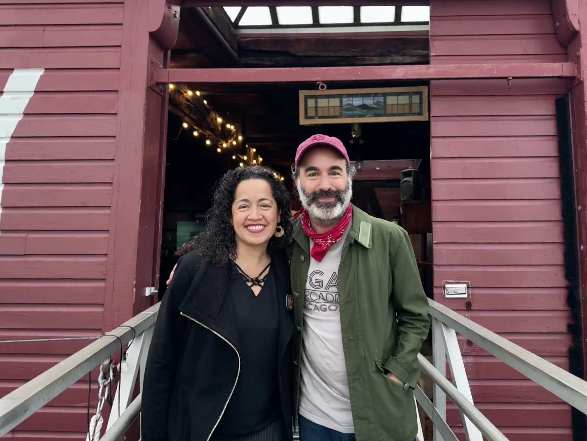
Kalwill recruited Bettina to join the organization he was forming called Friends of Fort Defiance. Since then the group has been off and running on developing the park, working with the Open Space Institute to help fund their idea. Kalswill recruited Tim Khalifa, who has spent seven years as an architect for public projects around New York City. Khalifa is also a Red Hook resident and met Kalwill four or five years ago. According to Khalifa, the two had been bouncing ideas off each other for a park on a desolate plot of land at the end of Coffey Street near Louis Valentino Park that is owned by UPS. Over time, as Kalwill learned about Fort Defiance and the history of Red Hook, the park plan began to take shape as a piece of living history.
“There was this opportunity to start to think about not just like, the idea of it becoming a park,” Khalifa said. “It’s more like, can this become something for Red Hook for the community that celebrates the history of Red Hook and at the same time provides green space for people in the neighborhood.”
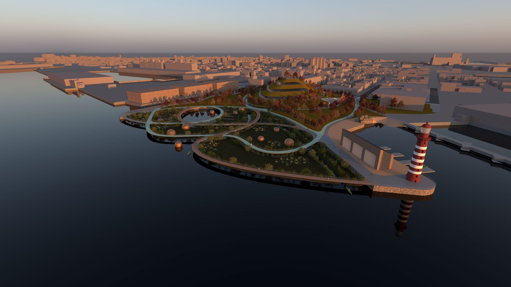
Their park plan features a hill similar to Cypress Tree Island where Fort Defiance once stood, a detail that might go overlooked by most visitors, but serves as a nod to the history of Red Hook. The plan also features a lighthouse as well as marsh lands that represent the marshes that once made up Red Hook. “I think once we sat down and started sketching, it became clear that the whole actual space and the story of the space can really be shaped by its history,” Khalifa said.
Not only will the park provide much-needed greenspace for Red Hook, it is also designed to serve as a barrier to sea and prevent flooding that has become all too common with climate change. During Hurricane Sandy, Bettina and Paul said that their street was one of the only streets that did not flood. They believe that’s because Coffey Street is slightly above sea level, as a result of the former Cypress Tree Island. “When Sandy hit and all of Red Hook flooded,except for my mother’s house,” Paul said. “ I did go out for a walk during the height of the surge. And I kind of saw the perimeter of what is I guess called Cypress Island. So that was the moment it dawned on us that that was most likely the site of Fort Defiance because the other areas were all swamp land and wouldn’t have had an attack.”
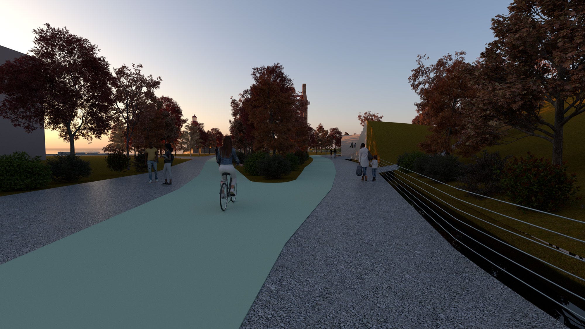
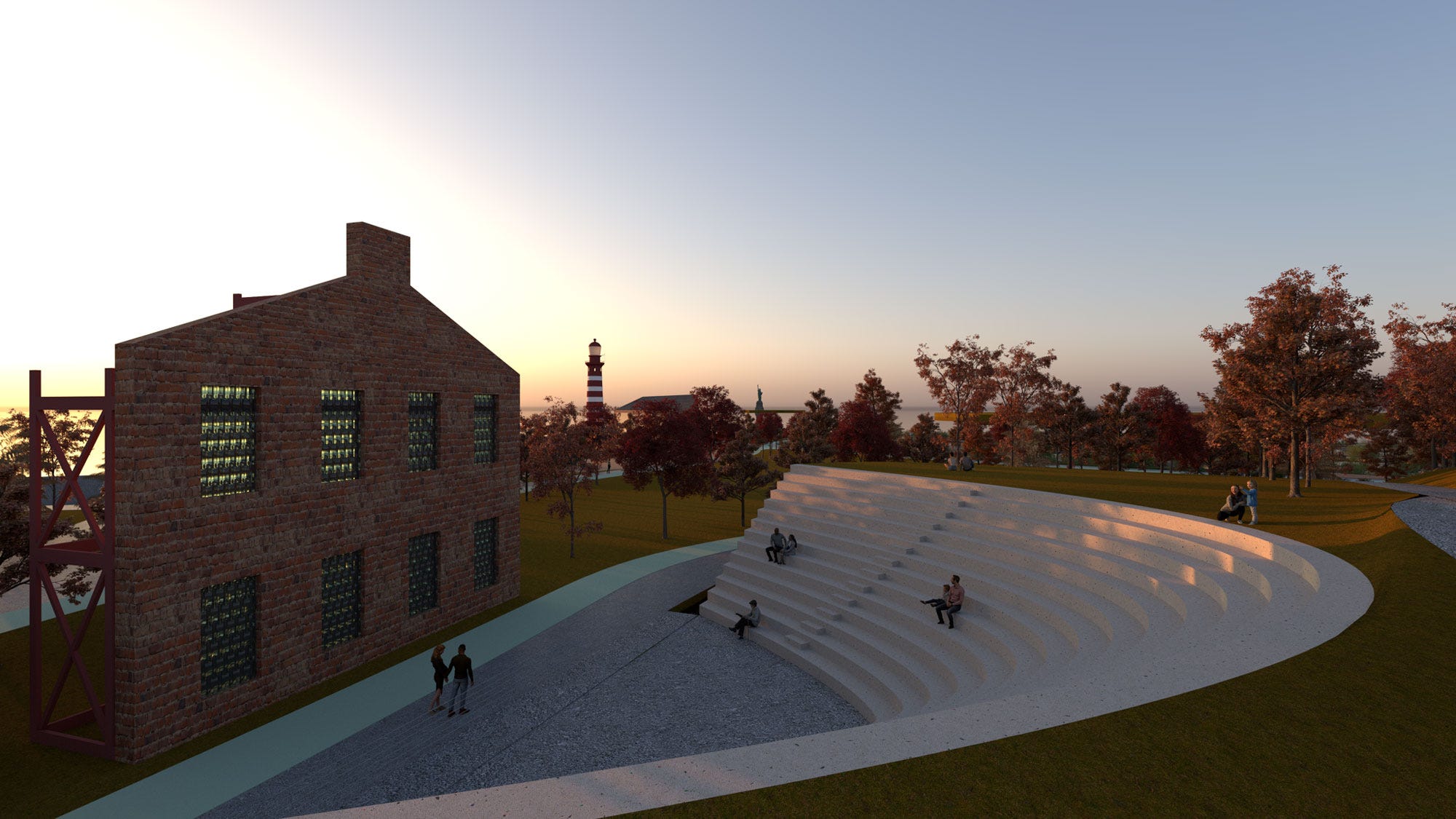
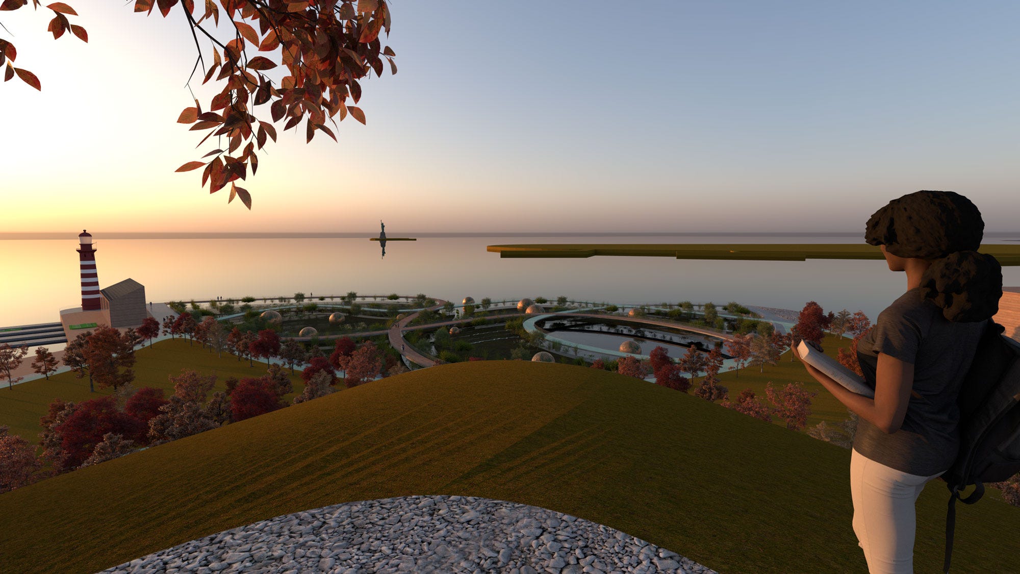
Renderings of the proposed park (Courtesy: Friends of Fort Defiance)
With the park plan developed, the Friends of Fort Defiance are working with the Open Space Institute on gathering support from the city and state, as well as finding a way to purchase the lot from UPS. They have also held two educational sessions for curious residents at the Waterfront Museum. According to Kalwill and Khalifa, they have received strong support for the project from those they have presented it to. The project has moved faster than expected according to Kalwill, who said that they are ten years ahead of schedule.
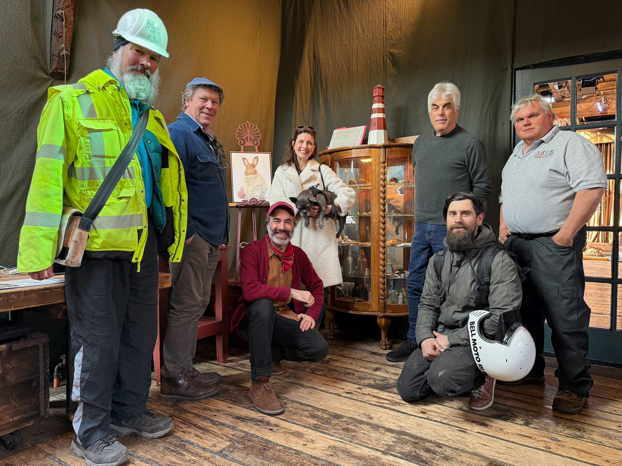
However, the park is just one piece of the puzzle. With the support of Brooklyn 250, a state funded program that is bringing the Battle of Brooklyn to life via free programing, the Friends of Fort Defiance have created two exhibits on Coffey Street that feature not just the cannonballs, but additional objects that Jonathan Bream and others have found in Red Hook. The exhibits are on view at 160 Coffey St and 169 Coffey St through August 30th. They also held an event on August 22nd in honor of the 250th anniversary of the battle, featuring a panel that included historians and those involved with the project. The organization has also worked to co-name Coffey Street as Fort Defiance Place. The renaming was passed by the New York City Council on June 30th, and Kalwill said they plan on doing a formal event to commemorate the co-naming at a later date.
Red Hook looks different than it once did 250 years ago and will certainly experience more change in the years to come. With these changes comes the very important question of how these changes will help protect the neighborhood from the pressing issue of climate change. The solution to this may be to look to history and revert the land to what it once was.